


(Story by Tony Sestito)
Picture this: It’s 1917, you live in New England, and your lovingly betrothed tells you that they want to go visit the bright lights of New York City. You could take a train, or perhaps a ferry, or you could take that shiny Mercer Raceabout sitting in your carriage house. You have a sense of adventure, and you pack your bags and hop in the ol’ horseless carriage. But how do you get there?
Of course, you could buy a map. But good automobile-focused road maps were hard to come by. But there was another, better option.
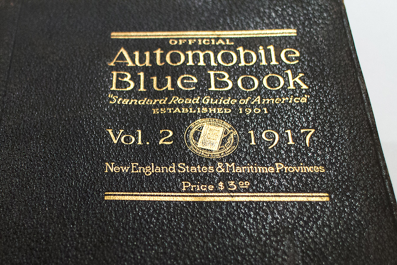
Enter the Automobile Blue Book. First published way back in 1901, it was a book that provided turn-by-turn directions to and from popular destinations across the United States, including all sorts of points of interest. Basically, it’s a paperback version of today’s modern full featured GPS units or that GPS app you use on your smartphone. For $3.00 (about $55.00 in 2015 money), you could buy one of the volumes of the book and have a method of planning a Brass-Era road trip. I have a copy of the New England edition from 1917 in my possession, so let’s check it out!
This is how it works: Much of the book is dedicated to turn-by-turn directions from point to point, and they include a map so you can see where you are going. There’s lists of various Points of Interest, including resorts, hotels, and even service stations. For something available way before many people even had a telephone, this is pretty modern.
Now, let’s crack open the book!

First off, this is a pretty serious book. It’s over 1200 pages, and there’s all sorts of info inside, from route planning, to points of interest, to ferry schedules.

The “Routes” they describe in the book are not to be confused with modern Interstate Routes. They are instead a route to get from point to point using various roads, made up by the publishers of the book. For instance, Route 1 takes you from New York City to New Haven, CT.

Here’s the map the book comes with. The routes on there, as mentioned above, were all created by the publishers, and based on the existing roads of the time. Remember, there were no major highways back in this era, so a lot of these are based on older postal roads and carriage routes.

Among the various routes, you will find historic footnotes and facts describing cities and towns of the region. Hey, I found my hometown of Hingham, MA! And that church is still standing and is still the oldest continuously used meeting house in the country, 98 years later.

The book is full of old maps of various regions, and some highlight various points of interest. Check out this map of 1917 Boston, MA. I know a couple of those landmarks are still around in one form or another.

I picked up this book at an antique store a few years back. As I was flipping through it, I noticed this yellowed note. Looks like someone ages ago was planning a tour of their own, but it didn’t get too far.

There’s this handy section in the back that acts as a quick guide for the motor laws of each state. One of the things that jumps out immediately is that some states had different registration rates depending on how much horsepower your vehicle made! That would be really interesting if that method of registration was still around these days in the US.
And the best part of any old publication… THE ADS!!!

Need some hands-free navigation help? Check out the Blue Book Holder! This giant book shelf strapped to your dash and held the book on whatever page you needed it opened to. And you thought a phone was distracting…

Right when you open the front cover, you are treated to this. The ad references that paved roads are becoming more commonplace, and these tires are meant to handle them. I can’t help but imagining these in a modern size and how ridiculous they would be.
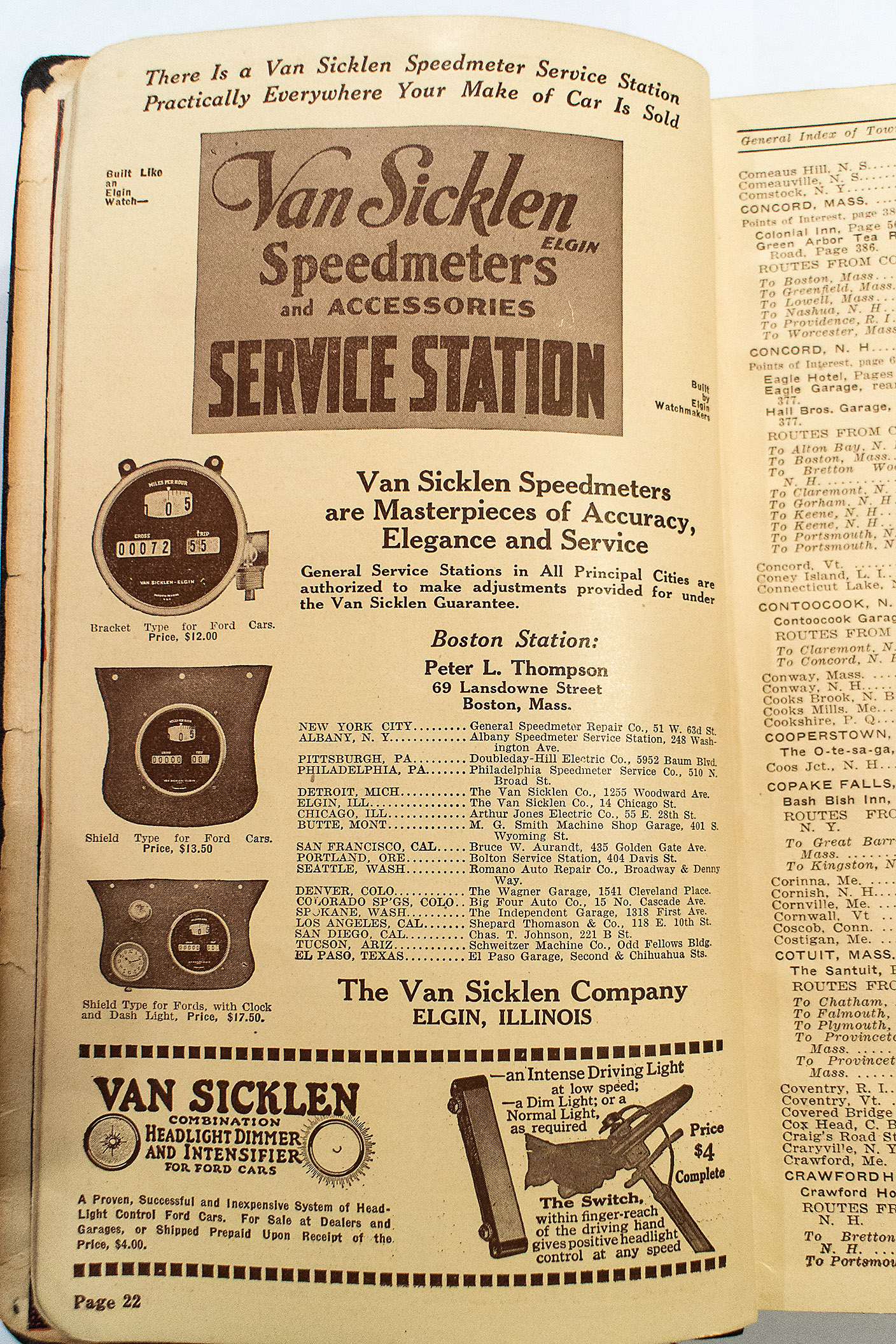
I’m always interested in old aftermarket parts, and these old speedometers are no exception. A trip meter must have been quite the luxury back then. A lot of cars into the 1980’s didn’t even have them.

Check out these “Touring” accessories! I’ll take some of those gloves, a pair of goggles, and a quart of Havoline, please.

Champion Spark Plugs have been around for a long time. This ad pretty much speaks for itself. They were popular then, and they are still popular now.

How do you keep your place in this huge book? With the coolest bookmark ever made, that’s how.
With swap meet season starting back up, or if your significant other drags you out to go antiquing, you may want to keep your eyes peeled for one of these books. They usually go for short money, and offer a great look into the early days of the automobile.


Blue Book – I thought this would have been about unidentified flying automobiles!
Pennsylvania Vacuum Cup tires were guaranteed for 6K miles, WOW!
Ha! In that first set of directions I know exactly where they are referring to . Right down Fordham rd past the Bronx zoo parking lot and under the train onto Pelham parkway. Still like that today. Bet it was all farmland then. Would be cool to follow the same directions today and see where you end up. I bet not many of the roads changed.